The Origins Africa has a huge mass spreading across two hemispheres, embracing the Equator and comprising a great variety of climate zones. This is why, during the radical changes which characterized our planet’s geological history, this gigantic tectonic plate always hosted areas offering favourable climatic conditions and which could be easily reached by on-land migration. In Africa, that natural passageway connecting different climates and regions is called Rift Valley. It is a deep depression gathering rivers and fresh water, flanked by high mountain ranges which – along an extension of 6,000 km – links Mozambique with the Syrian Highlands. Our early ancestors, the Hominidae, lived along this geological rift over 4 million years ago. At the time, Europe was still under a blanket of ice, but the evolution of mankind had already begun here, in Africa, the ancestral land of signs and legends. Lake Natron, Rift Valley, Tanzania George Steinmetz The shadow of a plane flying over the salt crust covering the lake’s surface in the African Rift Valley. The Rift Valley is a deep and continuous geographic trench, 6,000 km-long, that runs north to south from Syria to Mozambique, across the Red Sea and the great African lakes. It originated from the separation of the plate boundaries of Africa and Asia which occurred 15 million years ago, and creating a fracture several kilometres deep in some places and from 30 to 100 km wide. Lake Natron is a saline lake which in prehistoric times held abundant freshwater reserves. Today, due to high levels of evaporation, it is only 3 metres deep, a level which varies, depending on rainfall. The lake takes its name from Natron, a sodium-carbonate rich mineral that precipitates, forming large encrustations. The red colour is due to the presence of salt-loving microorganisms that thrive when temperatures rise to 50°Celsius and salinity increases. Natron – which in antiquity was used in mummification ceremonies as it absorbs water and acts as a drying agent- makes the lake’s waters similar to ammonia, and particularly hostile to life. Despite this, in Eastern Africa, it is where the Lesser Flamingo (Phoeniconaias minor) comes to breed, feeding on the water’s plentiful micro-organisms.
Paradise Lost The Sahara hasn’t always been a desert, as the prehistoric cave paintings found in Libya or in the Algerian Tassilj n’Ajjer show, ever since 10,000 BC, when the last ice age ended. Mountains covered with lush forests, plains cut through by great rivers and crossed by different animal species such as elephants, lions and giraffes; a habitat made humid and temperate by the ice melting, these are the places revealed by the ancient rock carvings, depicting every step of the human adventure from the Upper Palaeolithic onwards. Communities of hunters-gatherers who led errant lives, moving according to the seasons, with plenty of food and spare time to pursue religious practices and art. They will thereby give birth to the incredible explosion of visual art during Palaeolithic and Neolithic times, which will last for 7000 years. Wadi In Djeran, Illizi, Tadrart, Algeria Jacqueline Macou Engravings from the early Neolithic, near the Oasis of Djanet. On the sandstone wall are depicted one human figure, some giraffe and a specimen of the now-extinct species of bovines known as ”bubalus antiquus”. More recent writings carved in the Tuareg tifinagh language, can be seen along the margin of the engraving.
The End of a World Forced to devise new methods for gathering water, which was no longer available in abundance, from 8,000 BC the nomadic people of North Africa must settle and build their first stable shelters. Selecting plants and domesticating animals, cultivating and farming, modifying the natural environment in order to make it more productive – these were the changes that took place throughout the Neolithic millennia. Sophisticated knowledge, required to ensure the survival of ever-growing communities, stratifies and consolidates itself in the face of increasingly adverse climatic conditions. In fact, the earth is beginning to warm up again, little by little, while the Neolithic man assists and partly contributes to the destruction of that ancient post-glacial paradise. Desert will gain the upper hand around 4,000 BC, when pastures will have taken over the forests and most of the surface waters have dried up or sunk underground. That is how the soil, no longer protected by trees and subject to increasing temperatures and wind erosion, gives way to a combination of bare mountains and clusters of sterile sands. Djanet Oasis, Tassili n’Ajjer, Sahara, Algeria Yann Arthus Bertrand Prehistoric enclosed sepulchre from the Neolithic period, which began some 10,000 years ago and extended when the first forms of writing appeared, 5,000 to 4,000 years ago. In Tassili n’Ajjer these kinds of tombs are numerous, with the oldest dating back some 5,500 years. Dug into the hills, they are visible from far away: a first circle of stones surrounding the tumulus, beneath which lies the burial chamber, and a second circle that encloses the whole structure. Only men were buried there, laid on their side, with their heads facing east.
The Oases Civilization To be able to escape the ecological disaster caused by climate change and the depletion of natural resources, starting from 4,000 BC, the late-Neolithic communities are forced to learn from their primitive failure. They will therefore develop and fine-tune new practices for new survival strategies, and this is how – in the shadow of a primordial catastrophe which bears the seeds of rebirth – the Oases civilization will arise. It’s about small communities guarding extended territories, while huge human groupings migrate from the Sahara, to the Nile basin, from the Arabian Desert, to Mesopotamia, settling in the valleys of the great rivers. These are the areas where Sumerian and Egyptian organized states will rise, thanks to large-scale water management techniques, which will earn them the name of Hydraulic empires. Sidi Ali Ou Brahim Oasis, Adrar, Algeria Reza Deghati In the Sahara, the tea ceremony is a tradition, an art and a philosophy, strictly tied to the rules of hospitality that belong to the Oases’ culture. It is emblematic of a civilization that goes beyond the borders of modern states, while remaining faithful to the dictum of tolerance and welcoming spirit toward foreigners. The tea ceremony, in accordance with tradition, has to last one hour and a half. Within this framework the gestures follow a ritual that has a precise aesthetic code and the exchanges between participants happen to be inside the magic circle of the intimacy created by this special occasion. Poetry, songs and proverbs bear witness to the pleasure and serenity offered by each tea drinking session, both among nomadic and sedentary people. “The first tea is as bitter as life, the second as strong as love, and the third as sweet as death”; this Arab proverb indicates how many times the action of drinking tea has to be repeated to not disrespect the host. Yet, green tea , which together with mint leaves is the basis for the infusion, is a recent “discovery” for these people: it arrived in North Africa in 1854, when British cargo ships were forced to dock in Tangier, because of the Crimean War. The dissemination of this good begins thus from Morocco, marking a fundamental change in the Saharan populations’ daily habits. After having long been a beverage reserved for the privileged classes, mint tea has been adopted at all levels of society.
Hydraulic Empires During the Bronze Age the Egyptian and Sumerian civilizations – founded along the river basins on alluvial deposits of silt, loess and sand – develop their great monumental architecture, around 3,000 BC. This happened applying the experience acquired from building dams and canals to irrigate their land. The excavated material is in fact the raw earth used for the first pyramids, a direct evolution, both in Africa and Mesopotamia, of the Neolithic building techniques used for dykes and embankments. The major projects of the great Reigns, which required a huge amount of workforce that ended up settling in the area, create the circumstances for the establishment of the social basis of the ancient empires. Administrative bureaucracy and a progressive centralisation of power are born that way, the very opposite of the social economic model of the Oases civilization. Fayyum Oasis, Egypt Yann Arthus Bertrand The Meidum pyramid lies in the open desert, close to Al-Fayyum Oasis, on the edge of its cultivated area. The monument was probably built by Snefru, the first king of Dynasty IV during the Old Kingdom (2613 BC to 2589 BC) but never used as a royal tomb. The construction seems to represent the transition point between the early stepped pyramids and the great Giza monuments. Emerging from its mound of rubble like a huge bizarre tower, only three of the original eight steps are still visible today.
The First Oases All around the depressions, the basins of thaw lakes formed at the end of the last Ice Age, at this stage turned into salt marshes, Saharan populations of the late Neolithic settle on the highlands. There, in the caves within they take shelter, they obtain drinking water through percolation processes and start cultivating small gardens, where the date palm tree shows up, as it is depicted in Saharan early rock carvings of the Tassili N’Ajjer. The Phoenix Dactylifera – the mainstay of the Oasis and its agri-pastoral economy – is also definitely cultivated along the shores of the Persian Gulf, as early as 3,000 BC. It appears in Bahrain (the ancient Dilmun) and in Oman (the ancient kingdom of Magan) on artificially terraced and irrigated areas, where ancient water catchment systems enable early forms of agriculture. Used to collect water since 1,000 BC, the Aflaj of Oman are drainage galleries equipped with airshafts, still operating today in Oman’s Oases, with a distribution network extended over 2,900 km. A similar water system, known as Qanat, is most likely to have existed from an earlier time in Iran. In the same way in Egypt, toward the middle of 2,000 BC, the Oases of the western desert were already fertile havens of permanent settlement, regarded as the barns of the Old Kingdom. In the reports of Greek historian Herodotus, who travelled in Egypt in the year 440 BC., we will find out that Oases were yet well-known and had been identified with a specific name, wehe. Maqabil Oasis, Al Dhahira, Oman Ahmed Al-Shukaili Detail of a stone tomb in the necropolis of Bat, sitting on a high ground near the Oasis. The area is part of a monumental archaeological site of the Third Millennium AD that comprises – with Al-Khutm and Al-Ayn – rural settlements and irrigation systems. Here one can find the first applied examples of productive organization techniques that Saharan and Arabian communities would later develop in the Oases.
The Making of the Oasis It all starts with a date palm seed and the hand of a human being. A small hole dug in the ground, collects moisture and there the seed germinates, surrounded by dried branches protecting it from sand, and irrigated with water cleverly collected from the different aquifers that Oases peoples have been able to identify and utilise. This is what creates the Oasis effect, a life-conducive process capable of regenerating itself thanks to the synergy of different organisms, following the laws of nature. Even the wind, when cleverly directed, creates the dune that defends the fertile niche, capable of hosting life. The plant itself works as a shield against the sunbeams, it collects water condensation, attracts insects, produces organic matter and generates the soil and the humus on which it feeds. Adjir Oasis, Adrar, Algeria George Steinmetz Date palm trees grown in artificial hollows called ghouts. This renowned example of Saharan traditional agriculture does not rely on irrigation and is very common in Algeria and Niger, in areas where aquifers are found close to the ground’s surface.
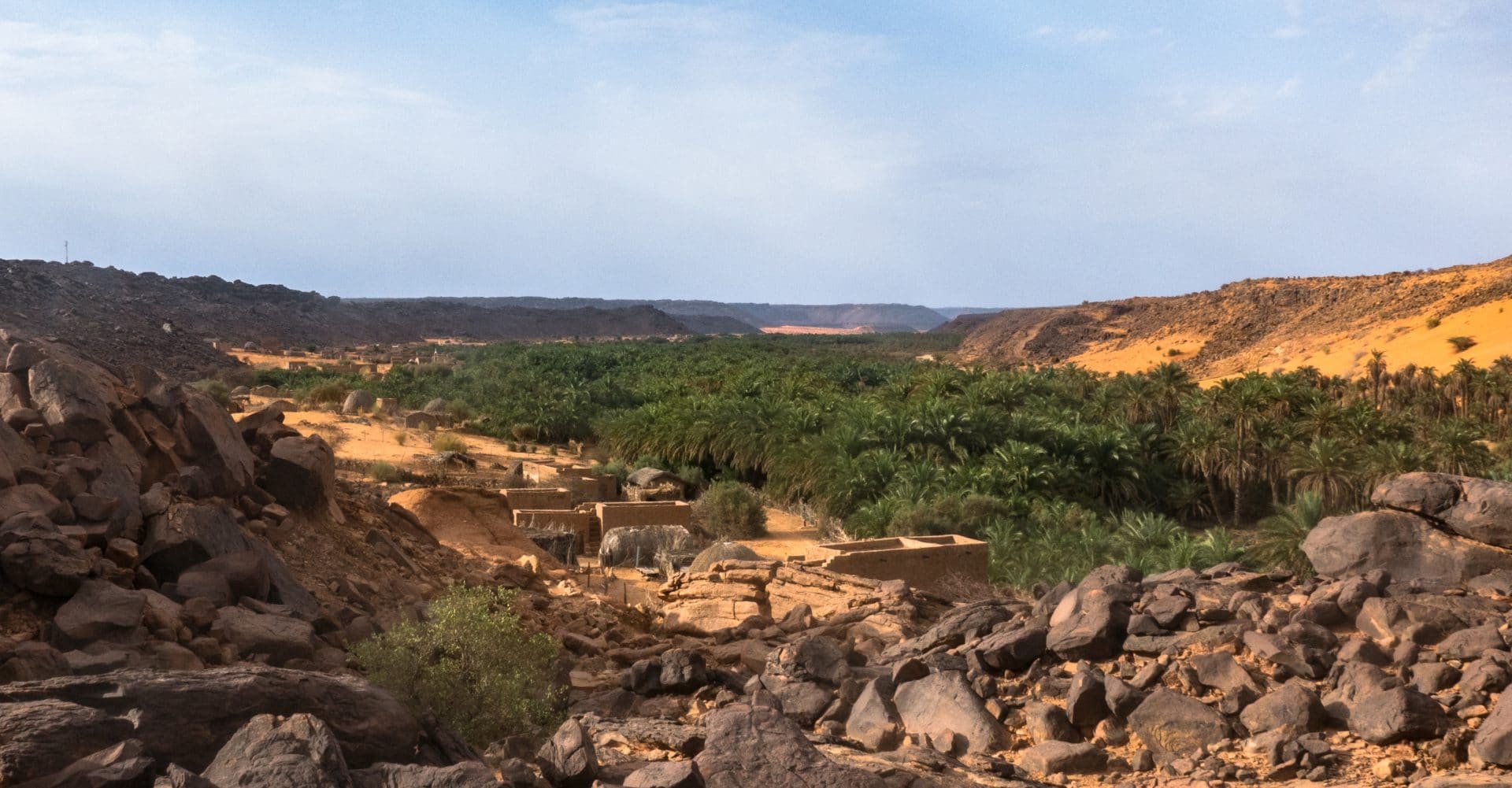
The Desert-Beetle Model The desert beetle climbs up the dune to capture water from the evening breeze that condenses on its bumpy back surface. Once the water is captured, small droplets will slide down into his mouth, to complete the miracle of quenching thirst. Just like the desert beetle, small communities in the Oases – regulated by patriarchal, religious or customary authorities and guided by a council of elders – make full use of their skilful practices of small-scale water management. The collection and allocation of water, either scarce or based on the apparently immaterial supply of humidity, frost and other superficial condensation, in fact require a very complex organization which must be collectively agreed upon, because even the slightest deviation can collapse the whole system. Terjit Oasis, Adrar, Mauritania Agron Dragaj The desert beetle is an insect that can catch the atmospheric vapour that condenses on the nanoscale bumps of his back. Therefore, it can be considered emblematic of the wise techniques of water collection in use in the Oases. The species, common in Ancient Egypt, was revered as a divinity. It is no coincidence that it was depicted as pushing the sun through the sky, and celebrated as a symbol of the forces of nature, in constant flux and transformation, always capable of regenerating.
What kind of Oasis? In the Sahara and in the vast desert extensions of Arabia, the Oases, with their villages either surrounded by or adjacent to the date palm groves, can be found in a variety of geo-morphologically different landscapes. Lumped together by the aridity of the soil, the hot weather, and a strong temperature variation between day and night, Oases exist thanks to water, the many systems used to draw it and collect it. Soil irrigation and date palm growing, the creation of the oasis effect which allows the onset of a life cycle, is an endeavour to which, over the millennia, people far apart from each other, have dedicated themselves by applying the same wisdom. Across highlands or the rocky terraces of mountain Oases, where man-made tunnels bring to the surface the residues of rain or melted snow; in the wadi Oases, found along the beds of prehistoric rivers – nestled between majestic rock faces or on sandy shores – where water seeps as a result of irregular flooding and is collected using wells or other devices; in the erg Oases – in the midst of great seas of sand – where water is obtained from the drainage of underground micro-flows and palm trees can be grown by artificially shaping the sand dunes to form enclosures as deep as small craters; in the sebkha Oases – on the edge of extensive depressions – the shores of ancient lakes which are now very salty or completely dried, where sometimes dozens of freshwater springs arise or, more often, wide tunnels are excavated, equipped with air shafts, from which water can be drawn to sustain villages and farmland. Inhabiting the desert, the lesson of the Oasis. Siwa Oasis, Matrouh, Egypt Yann Arthus Bertrand Aerial view of Lake Birket Siwa, showing the island with the remains of a small settlement. The water is so salty that you can see crystals nearly covering the surface. Siwa Oasis is a land of contrasts. The sand dunes, visible to the west of the town, are juxtaposed with more than a hundred natural springs of freshwater and hypersaline lakes. It’s this unique collection of features that brought tribes to settle here over 12,000 years ago. The Oasis now hosts a population of 25,000 people, and is found in the Qattara depression, in the north-west of Egypt. Much of the depression is below sea level: 133m at its deepest, making it the second lowest point in Africa, right after the Dead Sea. It is bound by steep slopes to the north and to the south. In the west it flows into the 72,000 sq. km of the Great Sand Sea. The numerous springs that supply water to the Oasis have their source in the Nubian Sandstone Aquifer System: the huge, non-renewable aquifer, the largest in the world, under Libya, Egypt, Sudan and Chad, which was formed 30,000-50,000 years ago.
Desert gardens Abolishing the distinction between the productive orchard and the ornamental garden, cultivated lands in the desert are called gardens. Shady land units that the Oasis’ agricultural tradition, after exploring nature’s generosity and its dangers, meticulously organises across three levels. At the highest level is the date palm tree and, below, olive and fruit trees; lastly, at the bottom, depending on the season, vegetables, cereals and forage for livestock. This is the origin of the unexpected green barrier against the invasive sands, cultivated by making the most of its microclimate. Tinghir Oasis, Souss – Massa – Draâ, Morocco Bruno Barbey An image recounts the 3 levels by which the Oasis traditional agriculture is organised. On the edge of the village built in rammed earth there are: date palm trees on the upper level, on the second level olive trees and fruit trees, and further down, vegetables and fodder for the animals.
Date Palm, the blessed tree “With its feet in the water and its head in the fire” – this is, according to an old Arab proverb, how the date palm grows in hot and dry climates, reaching 30 metres in height, able to thrive even in the most saline soil. At the basis of the Oasis ecosystem, essential defence against the desertification that threatens vast areas of the world, it grows between sky and sand. Under its immense crown of fronds, it is said by Muslims and Christians that Mary of Nazareth gave birth to Jesus, after having eaten fresh dates. Thanks to the this blessed tree, the Phoenix Dactylifera, man was able to live in the desert, creating fertile humus under its shade. By consuming its highly energetic, vitamin-rich, easily transportable and long life fruits, nomads and merchants were able to cross vast arid areas travelling along the ancient trans-Arabic and trans-Saharan caravan routes. Of this species, first found in the area of the Fertile Crescent, in 4000 B.C. several thousand different varietals are numbered. Usually propagated from stem cuttings and ready to bear fruit in 4 or 5 years, date palms have, it is said, “has as many uses as there are days in a year”: the wood and the fronds become firewood and building material; the young and tender parts can be eaten, either raw or dried to make flour; the seeds can be milled to extract oil for soap manufacture, or toasted to obtain a coffee-like beverage. Moreover, from the fresh fruit is dried and widely appreciated. Furthermore we have preserves, sugar and wine. Trees that can live to be more than a 100 years old, but rely on mankind to bear more fruit. For this reason, between the months of March and June, men repeat every year the ancient practice of manual fertilizing. Replacing winds’ work, they perch on tall ladders in order to reach the top of 40 female palms and scatter pollen from the racemes of one single male. This is the way to ensure each plant bears the maximum amount of fruit, 60 kg, and the big family clan – that every two months takes part in the harvest – can share the dates, setting aside, as it is customary, a quota of fruit for the poor. Oasis de Az Za’Faran, Al-Hudayda, Yemen Abduljabbar Zeyad Using a traditional belt, a young farmer climbs a palm tree to pick dates. This is an activity that requires acrobatic skills and physical resistance, since it occurs at an average height of 15 metres. Taking care of about 100 plant specimens – the number normally handled by one farmer – is no easy task and requires many more skills. There are at least a dozen technical interventions, such as pollination and pruning, which are needed year-round. It is obvious that this is an essential job for the economy, the ecological equilibrium and the survival of the Oasis, which is however increasingly abandoned by young people. Many also consider it too dangerous. It is useful to know that the Algerian Association BEDE has implemented a specific project to reduce the risks of injury regarding the maintenance of date palm trees. Date Palm, the blessed tree “With its feet in the water and its head in the fire” – this is, according to an old Arab proverb, how the date palm grows in hot and dry climates, reaching 30 metres in height, able to thrive even in the most saline soil. At the basis of the Oasis ecosystem, essential defence against the desertification that threatens vast areas of the world, it grows between sky and sand. Under its immense crown of fronds, it is said by Muslims and Christians that Mary of Nazareth gave birth to Jesus, after having eaten fresh dates. Thanks to the this blessed tree, the Phoenix Dactylifera, man was able to live in the desert, creating fertile humus under its shade. By consuming its highly energetic, vitamin-rich, easily transportable and long life fruits, nomads and merchants were able to cross vast arid areas travelling along the ancient trans-Arabic and trans-Saharan caravan routes. Of this species, first found in the area of the Fertile Crescent, in 4000 B.C. several thousand different varietals are numbered. Usually propagated from stem cuttings and ready to bear fruit in 4 or 5 years, date palms have, it is said, “has as many uses as there are days in a year”: the wood and the fronds become firewood and building material; the young and tender parts can be eaten, either raw or dried to make flour; the seeds can be milled to extract oil for soap manufacture, or toasted to obtain a coffee-like beverage. Moreover, from the fresh fruit is dried and widely appreciated. Furthermore we have preserves, sugar and wine. Trees that can live to be more than a 100 years old, but rely on mankind to bear more fruit. For this reason, between the months of March and June, men repeat every year the ancient practice of manual fertilizing. Replacing winds’ work, they perch on tall ladders in order to reach the top of 40 female palms and scatter pollen from the racemes of one single male. This is the way to ensure each plant bears the maximum amount of fruit, 60 kg, and the big family clan – that every two months takes part in the harvest – can share the dates, setting aside, as it is customary, a quota of fruit for the poor. Oasis de Chinguetti, Adrar, Mauritanie Agron Dragaj Dattes sur une branche de palmier, au premier stage de croissance. Les dattes ont quatre phases de maturation, connues en toute la planète avec leur noms arabes : kimri (âpre) khlal (croquant) rutab (mur) tamr (séché au soleil).
Hydrogenetic Communities “Water mines” is the most appropriate definition for all those systems which, within the Oases, are based on the prehistoric techniques of hydro-genesis, the creation of water. The result of ancient environmental knowledge, water mines make use of a variety of collection methods and for this purpose specific devices are created – at times hardly recognisable as such – capable of drawing water even from the atmosphere. Imposing underground networks of drainage galleries, the excavation of embankments and canals, headraces and huge grids of ditches, terraces along the wadis, all these structures have historically been created through the cooperative effort of the entire community. Hence, the localization of areas assigned to house the dwellings and the palm groves, dictated by the layout of the waterways. As a consequence also the need for common agreements to regulate every activity: the scheduling and duration of irrigation; the selection and rotation of the crops suited to withstand an arid environment; the time allocated to work – both individual and collective – on the fields. Adrar Oasis, Adrar, Algeria Pietro Laureano The water master, he whom the community has entrusted to manage the ingenious water catchment and distribution system of the Oasis, shows the perforated copper plate, hallafa. This is the tool which contains the measuring units used to verify water capacity at the outflow of the foggara, the underground drainage gallery that runs through the desert.
The Desert Ecosystem The desert is a precise ecological model, which establishes itself in specific climatic conditions, with its own laws, its own biological activities and an overall balance that the people of the Oases know how to respect and maintain. The establishment of the desert is the result of a natural cycle, which followed the extremely long geological evolution of our planet’s history and preserved a habitat rich in biodiversity. Desertification, mankind’s heavy responsibility, is instead a very abrupt change to which the planet’s physical and biological entirety cannot adapt in time. The ensuing degradation is absolute, without any chance whatsoever of restoring a life cycle with new laws. It so happens that the desert itself can undergo desertification, as even a landscape of such extraordinary strength – apparently immutable – is, just like any other ecosystem, a fragile environment. Therefore any human action unable to find its bounds will have lasting and devastating effects. M’Hamid El Ghizlane Oasis, Drâa- Tafilalet, Morocco Rosa Frei Euphorbia Guyoniana, spontaneous desert vegetation on the dunes of Erg Lihoudi, an example of flora that includes ephemeral, annual and perennial species. Many of these are perfectly suited to arid conditions, while others with a very short life-span, are dependent on the occasional rainfall.
The Sahara There are many deserts, both in Africa and the rest of the world, but the Sahara somehow represents them all. It covers one quarter of the African continent, extending for 5000 km from the Atlantic Ocean to the Red Sea and for 2000 km, from the Atlas Mountains to the Sahel, its southern shore. It is a hot desert, where temperatures can exceed 50°C but in winter nights can drop below zero. Due to the absence of vegetation, its surface, constantly exposed to violent atmospheric agents, shows the brutality of erosion on the earth. The combination of sun, wind, water vapour and thermal variations between day and night expands and crumbles even the hardest rocks. Thus, sands are generated, the mass of siliceous grains that can destroy everything and form big dunes, which, in prehistoric times, diverted or buried the course of great rivers. Tin Merzouga Dunes, Sahara, Algeria George Steinmetz Near the border with Niger, south of the Djanet Oasis, the Algerian Tadrart is often described as the world’s most beautiful desert: a maze of orange coloured dunes over 1000 metres in hight, dotted with rock peaks and pinnacles chiselled by the erosion.
Water Atlas Acting just like a pump, the daytime scorching temperatures of the Sahara suck moisture out of the underground substrata. This brings to the surface the salts that will remain on the ground as a consequence of evaporation, making it sterile. Nevertheless, despite the almost total lack of rainfall, the Sahara is not completely dry. Its subsoil holds huge water supplies, aquifers which have been filled millions of years ago and others which are replenished by the occasional rainfall, or the drainage of atmospheric humidity overnight. But that is not all. Even today, the huge empty space shows the fossil skeleton of the prehistoric rivers, the wadis, where superficial waters hardly flow, but in which floods of exceptional scale can still occur suddenly, many years from one another. In the hydrographic network inscribed across the entirety of the desert’s surface, the lower areas correspond to the great depressions, points of convergence of a great number of wadis. Salt marshes, large evaporated lakes, with a treacherous and sterile top-layer encrusted with salt. Constantly swept by strong winds that keep them free from sand, the chott are located in the northern side of the Sahara – where superficial humidity can still be found – and the sebkha, in the inner desert, where all surfaces are completely arid. Sahara Desert, Adrar/Tamanghasset, Algeria Christian Lemâle Aerial view of the prehistoric hydrographic network in the Algerian south. Throughout the Sahara desert, one can easily observe the tracks of great rivers which, starting from the end of the last glaciation in 10,000 BC, have profoundly marked the Earth’s crust.
Erg, the Sea of Sand Erg is the name of the vast scenarios created by the wind, entire regions of dunes spreading out in long ranges of hundreds of kilometres, a sea of sand that extends as far as the eye can see. Just like the Great Eastern Erg in Algeria, towering dunes – aligned in parallel with the direction of the prevailing winds – can reach a height of 200 m. The ergs’ shape displays complex geometries, which vary in response to Aeolian processes and the presence of rocky outcrops. Their position, however, doesn’t change, by staying at the outlet of the wadi network, the fossil rivers that dragged the first sand deposits from which ergs have originated. That is why, at the foot of a big dune, which looks as it might swallow them any minute, hundred-year old Oases stand safely and have never been in danger. Just like the sea on the shores, erg’s “sand front” is constantly moving, but it doesn’t pose a threat unless catastrophic events unfold. M’Hamid El Ghizlane Oasis, Souss-Massa-Drâa, Morocco Rosa Frei On the outskirts of the Oasis moving westwards, the Erg Lihoudi sand dunes mark the beginning of the desert, a way station for nomadic herdsmen.
Wadi, the Prehistoric River Across the vast and flat expanses of the deserts, as seen from the sky, the wadis are easily spotted. Like arteries of a powerful circulatory system, the ancient and now dried-up prehistoric rivers take various shapes. Gigantic canyons, but also narrow incisions between tall rock faces, or ample tracks running through a sea of sand dunes. In these prehistoric riverbeds, flash floods caused by rainfall on distant mountains, irrupt suddenly and violently, ensuring in ages the life of hundreds of Oases along their course. At these events the water flow, which is often slowed down using ancient and ingenious barrage systems, is absorbed and remains underground: replenishing, in such way, the aquifers. From these water reserves, any number of wells and traditional collecting systems will harvest water for irrigation and domestic use in the villages and in the palm groves scattered along the sandy banks. Sand dunes too, have a function in the replenishing of groundwater: like an enormous spongy mass, the dunes withhold the water preventing its evaporation and the flow, albeit very slowly, continues under the wadi bed. For millions of years it’s almost invisible course, by means of subterranean micro-flows, converges into the Prehistoric hydrographic network ending up in the great Saharan and Arabian depressions. Wadi Damm, Ad Dakhliyah, Oman Ahmed Al-Shukaili In the prehistorical riverbed – a deep canyon excavated by the flow of the river through the millennia— the wadi Damm still runs year-long , but with a reduced flow rate. In this area, one can find the vestiges of the Bat necropolis and of Al-Ayn settlements, the most ancient example of the “Oasis Civilization” of the Third Millennium BC.
The boundaries of the Oasis In accordance with tradition, nomadic and semi-nomadic desert tribes provide the connection between different Oases, maintaining contacts and conveying information. Thanks to them, Saharan and Arabian Oases have never been culturally isolated. Their boundaries have ideally embraced the faraway regions from which came the valuable goods that travelled along caravan routes. Owing to the existence of the Oases, ancient trades flourished for many centuries, setting up strategic markets for the economies of the great Empires of the past. Ouargla Oasis, Algeria Yann Arthus Bertrand Pink flamingos flying over Chott Oum Erraneb. It is a transit area on the migration route that runs across the Sahara and ends on the Western African coast. Called the “bird with wings of flame” by Ancient Greeks, the pink flamingo (Phoenicopterus ruber roseus) is the only flamingo living in Europe, where it sojourns from April to October. A shorebird, it feeds in saline wetlands. It owes its colour to the carotenoid pigments of the small crustaceans, that are its favourite food.
The villages of the Oasis The architectural heritage enclosing the history of entire peoples’ adaptation to climate – consistent with the choice of natural building materials – these are the villages of the Oasis. Most of the time, they appear as fortified complexes of remarkable plastic unity, radiating the mineral colours of the ground they come from. The extraordinary example of fusion between man’s work and nature. A dense urban fabric, designed to reduce sunlight-exposed surfaces to a minimum; building units, some six storeys high, leaning against one another, mainly opened northward. Extremely narrow and winding alleys, taking advantage of the shadow projected by the tall facades and trapping the cool night air. Attics extending like bridges over the urban pathways generating draughts of air, the so-called Bernoulli effect, high and low pressure areas which offer unexpected refreshment. The same function is performed by covered areas that replace squares, as places for rest and discussion. The mosque, the humble dwellings and the richer homes, it is all one big, unique village-building, scattered with terraces in the place of roofs. The house in the Oasis, completely inward facing, opens up to the sky through its patio or the inner courtyard. This is the internal core around which domestic life is organised, using spaces according to a season-driven nomadism. Architecture and construction, in keeping with tradition, employ materials such as raw earth or stone. Proportions are dictated by the tools available, or by nature. It is the case of roofing slabs, made with date palm trunks which limit the size of the rooms, due to their poor structural resistance. In the Oasis the village is the architectural set that stems from the wisdom of custom and it results in a fairy-tale beauty, since it is unmovable. Even though extremely functional in every respect, raw earth buildings become very fragile if exposed to heavy rain, needing constant maintenance. Beni Isguen Oasis, Ghardaïa, Algeria George Steinmetz Aerial view of Beni Isguen, the last of five Ibadi villages established one after the other since the year 1000, over the rocky spurs along the wadi M’Zab. Conceived in the 14th century, it has a beehive structure of identical dwellings clustered concentrically around the mosque. This is located on the village’s highest point, so that the minaret could be used as a watch tower to guard against the frequent incursions of marauders. In the first circle, the buildings that surround the mosque are the homes of the religious hierarchies and then, in descending order, those of everyone else. This arrangement is the precise reflection of the role performed by each member within the community, revealing a uniquely original city planning approach, where the tenets of the Ibadi religious doctrine merged with the economic needs of the Oasis. The villages of the Oasis The architectural heritage enclosing the history of entire peoples’ adaptation to climate – consistent with the choice of natural building materials – these are the villages of the Oasis. Most of the time, they appear as fortified complexes of remarkable plastic unity, radiating the mineral colours of the ground they come from. The extraordinary example of fusion between man’s work and nature. A dense urban fabric, designed to reduce sunlight-exposed surfaces to a minimum; building units, some six storeys high, leaning against one another, mainly opened northward. Extremely narrow and winding alleys, taking advantage of the shadow projected by the tall facades and trapping the cool night air. Attics extending like bridges over the urban pathways generating draughts of air, the so-called Bernoulli effect, high and low pressure areas which offer unexpected refreshment. The same function is performed by covered areas that replace squares, as places for rest and discussion. The mosque, the humble dwellings and the richer homes, it is all one big, unique village-building, scattered with terraces in the place of roofs. The house in the Oasis, completely inward facing, opens up to the sky through its patio or the inner courtyard. This is the internal core around which domestic life is organised, using spaces according to a season-driven nomadism. Architecture and construction, in keeping with tradition, employ materials such as raw earth or stone. Proportions are dictated by the tools available, or by nature. It is the case of roofing slabs, made with date palm trunks which limit the size of the rooms, due to their poor structural resistance. In the Oasis the village is the architectural set that stems from the wisdom of custom and it results in a fairy-tale beauty, since it is unmovable. Even though extremely functional in every respect, raw earth buildings become very fragile if exposed to heavy rain, needing constant maintenance. Ghadames Oasis, Tripolitania, Libya George Steinmetz One of the gates to the ancient city, at sunset. In the early 1980s, as for all the Libyan Oases – Colonel Mu’ammar Gheddafi ordered the evacuation of the Medina, moving its inhabitants to nearby neighbourhoods built in concrete. The total inadequacy of such a building material in the local climate, not to mention the appearance and structure of the settlements, is the reason that leads many, in the summer or during traditional celebrations, back to the intimacy and cooler temperatures offered by the old town. The local Medina has peculiar features: it is divided into seven districts enclosed by walls, each with its own wells, squares, markets and mosques. A maze of streets, overlooked by houses with interiors full of niches, coloured glass features and mirrors, creating shimmering light effects on frescoed walls.
Nomads Thanks to the proceeds from the caravan trade, which climaxed in the Early Middle Ages, nomads have been – for centuries – the economic elite of the Sahara and the Arabian Deserts. Shepherds, land owners in the Oases, merchants of spices, gold and slaves, they have at times turned sedentary as a consequence of climate change. Nomad tribes passed on their culture through the patterns of rugs, the shapes of jewels, the decorations of everyday objects, the ritual tattoos on their bodies and the shimmering plaits of women’s hair. Today, despite being a small minority who wanders across blurred borders, breeders of dromedaries and goats keep appearing almost out of nowhere – and in the middle of nowhere – following scattered herds. This elite, belonging to highly hierarchical tribal societies, has always been the warrior caste of the desert. Its members are able to observe the most impalpable elements and to confer them unusual functions. Air, light, sound, heat, reveal to nomads the nature of the terrain, meteorological changes, the presence of potential pastures, of water, and can show them the right direction to take. During a transhumance, or on a caravan route, paying attention to the slightest change within the habitat can save a life, for example while travelling on the last Salt Routes, Taoudenni’s Azalaï in Mali, or Bilma’s Taghlamt in Niger. Adrar Region, Mauritania Michał Huniewicz Maure nomads during a stopover in the vicinity of the Chinguetti Oasis. Both herdsmen and merchants at the same time, they are still present in those areas of Mauritania that – during the Middle Ages – saw the golden age of Saharan caravan trade, between the Maghreb and Western Africa.
Dromedary, the ship of the desert “It’s wise to believe in Allah” the old saying goes “but it’s smart to tie up your camel”. And certainly, for the desert dweller no possession is more precious. Found mostly in central Asia, the Bactrian camel has two humps, while the single humped dromedary, smaller and faster, lives in Arabia, North Africa and India. First domesticated 3000 years ago in the south-east of the Arabian peninsula, it is traditionally herded by Bedouins of Arabia and Saharan Tuareg, nomads or semi-nomadic tribes, the caste of warriors and merchants that has made terrestrial trade flourish crossing deserts with dromedaries as ships, and Oases as harbours. This living organism of utter perfection, unique in terms of adaptability, intelligence, resistance to fatigue, has a long life span, 50 years. It feeds on grass and the thorniest shrubbery, grazing in constant movement, not exhausting the vegetation of its sparse pastureland. Everything of its physiology speaks of the perfect adaptation to its habitat: the shape of ears, the eyelids, the double row of lashes – which shield from the sun and sandy winds – the nostrils, which moisten the air on each inhalation. Its famous hump, made of fibrous tissue and fat, is a strategic device for life in high temperatures: an energetic supply concentrated into a single point, which allows the rest of the body to disperse heat. In the colder season a female dromedary can produce up to 12 litres a day, even without drinking any water for several weeks. This is why the caravans start moving in the Fall, when the animals are fatter and better prepared to face a long journey, to be completed walking in a single file, each dromedary expertly moving in the shade of the one that goes before. Erg Aouker, Tagant, Mauritania Giancarlo Salvador Nomadic herdsmen of dromedary camels water their animals. The spring of Hassi Fouini is located on the edge of what was once the prehistoric lake Aoukar. On the shores of this great basin, archaeological excavations have unearthed the remains of a large number of villages. These are the testimony of an ancient civilization that flourished between 1700 and 400 BC. Dromedary, the ship of the desert “It’s wise to believe in Allah” the old saying goes “but it’s smart to tie up your camel”. And certainly, for the desert dweller no possession is more precious. Found mostly in central Asia, the Bactrian camel has two humps, while the single humped dromedary, smaller and faster, lives in Arabia, North Africa and India. First domesticated 3000 years ago in the south-east of the Arabian peninsula, it is traditionally herded by Bedouins of Arabia and Saharan Tuareg, nomads or semi-nomadic tribes, the caste of warriors and merchants that has made terrestrial trade flourish crossing deserts with dromedaries as ships, and Oases as harbours. This living organism of utter perfection, unique in terms of adaptability, intelligence, resistance to fatigue, has a long life span, 50 years. It feeds on grass and the thorniest shrubbery, grazing in constant movement, not exhausting the vegetation of its sparse pastureland. Everything of its physiology speaks of the perfect adaptation to its habitat: the shape of ears, the eyelids, the double row of lashes – which shield from the sun and sandy winds – the nostrils, which moisten the air on each inhalation. Its famous hump, made of fibrous tissue and fat, is a strategic device for life in high temperatures: an energetic supply concentrated into a single point, which allows the rest of the body to disperse heat. In the colder season a female dromedary can produce up to 12 litres a day, even without drinking any water for several weeks. This is why the caravans start moving in the Fall, when the animals are fatter and better prepared to face a long journey, to be completed walking in a single file, each dromedary expertly moving in the shade of the one that goes before. Douz Oasis, Kebili, Tunisia Patrick Zachmann Negotiations taking place during the buying and selling of a dromedary. Every day, on the Oasis’ main square, the large market hosts numerous nomadic herders with their animals waiting for potential customers.
The Incense and Spice Routes A driving force in the world economy since early Antiquity, caravan trade owes its development to three key players: the Oases, providing water supply, many of which flourished into legendary and prosperous market towns; the nomadic communities, in charge of exchanges and transportation; the dromedary camel, the ship of the desert, first domesticated in the Arabian peninsula in the I millennium BC. It therefore happens that – from 700 BC onwards – precisely the trans-Arabic caravan routes, become the battleground where commercial interests of the great empires – Babylon, Egypt, Greece, Rome -came up against each other. The most important one was the Red-Sea Route, connecting the Mediterranean to the coastal areas of South Arabia facing the endless Indian Ocean. These were the areas where spices where grown, but which also became important trading posts for a variety of goods coming from India, Ceylon, Malaysia, China. When the demand for such goods, from 300 B.C. onwards, took off across the entire Mediterranean, incense becomes the most expensive and sought after, especially the strain coming from Yemen highlands. It is the fragrance that “ravishes the senses with delight, as a thing divine and unutterable”, in the words of Greek historian Diodorus Siculus. In the same way, a wide range of other “aromata” will travel in the following two centuries on these same routes, traded to be used as seasonings, perfume, in medicinal and cosmetic preparations: myrrh and aloe, balsam, together with cinnamon, cassia and cumin, cardamom and saffron from India and China, but also precious metals, wood and ivory. On the basis of a cost-benefit assessment, it is the Romans, in the 1st century A.D., who put an end to the golden age of trans-Arabian caravan trade, redirecting their commercial traffic onto the more convenient, safe and newly opened, maritime routes, although a smaller-scale caravan trade will continue, however, up until the second half of the Twentieth century. Ancient Map of the Arabian Peninsula, dating 1654 AD Library of Congress, USA “Arabia Felix “was the name the Romans attributed the south and the southwest of the Arabian peninsula, a legendary region which they imagined as extraordinarily fertile because incense hailed from this area, and spices from India travelled through its districts. Arabia “Felix” was indeed the opposite of what they called “Arabia Petraea”, the ancient Sabean reign in the northeast which had become a Roman province since 106, and of Arabia “Deserta”, the immense territory at the centre of the peninsula which was inhabited by nomadic tribes. It was therefore to conquer Arabia Felix and its ports, that Emperor Augustus ordered Aelius Gallus, the prefect of Egypt, to establish an expeditionary force in 26 BC. Despite its 10,000 men, the Roman army was decimated for the lack of correct geographic information and being unprepared to face the extreme climactic conditions. That happened after the failed besiege of Māʾrib, the capital of Saba’s reign, where one could admire the hydraulic masterpiece of Antiquity, the dam which was built to irrigate 100 km² in the open desert. The Incense and Spice Routes A driving force in the world economy since early Antiquity, caravan trade owes its development to three key players: the Oases, providing water supply, many of which flourished into legendary and prosperous market towns; the nomadic communities, in charge of exchanges and transportation; the dromedary camel, the ship of the desert, first domesticated in the Arabian peninsula in the I millennium BC. It therefore happens that – from 700 BC onwards – precisely the trans-Arabic caravan routes, become the battleground where commercial interests of the great empires – Babylon, Egypt, Greece, Rome -came up against each other. The most important one was the Red-Sea Route, connecting the Mediterranean to the coastal areas of South Arabia facing the endless Indian Ocean. These were the areas where spices where grown, but which also became important trading posts for a variety of goods coming from India, Ceylon, Malaysia, China. When the demand for such goods, from 300 B.C. onwards, took off across the entire Mediterranean, incense becomes the most expensive and sought after, especially the strain coming from Yemen highlands. It is the fragrance that “ravishes the senses with delight, as a thing divine and unutterable”, in the words of Greek historian Diodorus Siculus. In the same way, a wide range of other “aromata” will travel in the following two centuries on these same routes, traded to be used as seasonings, perfume, in medicinal and cosmetic preparations: myrrh and aloe, balsam, together with cinnamon, cassia and cumin, cardamom and saffron from India and China, but also precious metals, wood and ivory. On the basis of a cost-benefit assessment, it is the Romans, in the 1st century A.D., who put an end to the golden age of trans-Arabian caravan trade, redirecting their commercial traffic onto the more convenient, safe and newly opened, maritime routes, although a smaller-scale caravan trade will continue, however, up until the second half of the Twentieth century. Shibam Oasis, Hadramawt, Yemen George Steinmetz Shibam was built in strategic position along the Incense and Spice Route, in the first Millennium BC then reconstructed over the earlier settlement that had been partially destroyed by a flood in 1532. The town stands within its fortifications on a rocky spur, several hundred metres above the wadi bed. The perfect grid formed by its streets and squares, studded by tower-houses built using raw-earth bricks, is the most significant surviving example left in Yemen of traditional hadrami architecture.
The Salt and Gold Routes Since the prehistorian era, trade exchanges, which are the most easily quantifiable aspect of a wider and multiform exchange of cultural, social and religious values, have connected sub-Saharan Africa to the Mediterranean. A century after the birth of the prophet Mohammad, in 700 A.D., the main trans-Saharan route runs along the westernmost margin of the great desert, where the Oasis of Sigilmassa in Morocco will become a main stop. This rich emporium surrounded by the sands was a market-city, selling the most precious goods of the time: gold and salt, ivory, ostrich feathers, and also slaves. Along this axis Arab merchants spread the Islamic faith and created a common, integrated economic system. Settlers and nomads, Arab, Berber, Black, producers and traders, Muslims, Jews, Christians, Animists, everyone participates over the centuries in this common market, until a new route – running in the central Sahara and reaching the sea by cutting through the Libyan desert – will prevail around 1300. Tuaregs Kel Air, breeders of dromedaries, warriors and merchants, will seize control, since then, of trade exchanges. This due to the fact of being settled in a key zone, the vast highland which lies between Niger and the edge of the Sahel. The “new” caravan route will continue to be used up until the 19th century, even though since the year 1500 the presence of Portuguese commercial strongholds, on the Atlantic, will shift most trades from sub-Saharan Africa towards maritime transport. Gold from Mali and Ghana, but also “white gold”, the purest rock salt extracted from the mines in Mali, Mauritania and Niger. These are the goods with the highest market value and the best quality to weight ratio, therefore justifying the high expense of men and animals during a no less than 60-day-long journey. Gold and salt became key tools for the exchanges, making the fortune, from the year 1000 and for centuries, of a legendary city: Timbuktu. This was also the station of arrival of a salt caravan route, the Azalaj of Taudenni stretching over 600 km in Mali, still in use today between March and November. The same as it happens for the Taghlamt in Niger, another salt caravan route stretching from Agadez to the salt flats of Bilma, that yet stands the competition of trucks using modern roads. Tichitt Oasis, Adrar, Mauritania Yann Arthus Bertrand A dromedary caravan transporting merchandise across the desert is approaching the Oasis. Throughout the Sahara, the dromedary, raised for its milk, meat and also for its wool, is an important part of the national livestock population. For thousands of years, thanks to its perfect adaption to extreme climactic conditions, the dromedary has enabled the development of new commercial routes through the deserts, and at the same time while has been instrumental in cultural exchanges and the diffusion of religions. The Salt and Gold Routes Since the prehistorian era, trade exchanges, which are the most easily quantifiable aspect of a wider and multiform exchange of cultural, social and religious values, have connected sub-Saharan Africa to the Mediterranean. A century after the birth of the prophet Mohammad, in 700 A.D., the main trans-Saharan route runs along the westernmost margin of the great desert, where the Oasis of Sigilmassa in Morocco will become a main stop. This rich emporium surrounded by the sands was a market-city, selling the most precious goods of the time: gold and salt, ivory, ostrich feathers, and also slaves. Along this axis Arab merchants spread the Islamic faith and created a common, integrated economic system. Settlers and nomads, Arab, Berber, Black, producers and traders, Muslims, Jews, Christians, Animists, everyone participates over the centuries in this common market, until a new route – running in the central Sahara and reaching the sea by cutting through the Libyan desert – will prevail around 1300. Tuaregs Kel Air, breeders of dromedaries, warriors and merchants, will seize control, since then, of trade exchanges. This due to the fact of being settled in a key zone, the vast highland which lies between Niger and the edge of the Sahel. The “new” caravan route will continue to be used up until the 19th century, even though since the year 1500 the presence of Portuguese commercial strongholds, on the Atlantic, will shift most trades from sub-Saharan Africa towards maritime transport. Gold from Mali and Ghana, but also “white gold”, the purest rock salt extracted from the mines in Mali, Mauritania and Niger. These are the goods with the highest market value and the best quality to weight ratio, therefore justifying the high expense of men and animals during a no less than 60-day-long journey. Gold and salt became key tools for the exchanges, making the fortune, from the year 1000 and for centuries, of a legendary city: Timbuktu. This was also the station of arrival of a salt caravan route, the Azalaj of Taudenni stretching over 600 km in Mali, still in use today between March and November. The same as it happens for the Taghlamt in Niger, another salt caravan route stretching from Agadez to the salt flats of Bilma, that yet stands the competition of trucks using modern roads. Salt Route, Ténéré Desert, Niger Alissa Descotes Toyosaki Tuareg merchants, participating to the Taghlamt caravan, rest after a day’s walk. Their crossing, a 1400km trip across the Teneré desert, from Agadez, to the Bilma’s salt-pans and back, still takes place between October and November, and lasts over a month. It was recently recorded in the 1 hour documentary « Caravan to the Future » . At the beginning of the 1900s, the caravan was made up of 10.000 dromedaries, a procession that spread for 25km. In this image, beside the two men, are the salt loaves in conical shape, kantu, which are carried on the dromedaries’ backs and will be sold at the market in Agadez.